Even in the 21st century, there are places on Earth that very few people have visited. These areas contain desolated desert interiors, solitary mountaintops, remote Arctic ice floes, and Antarctica’s expansive frozen ice sheets. Yet, let’s not forget about the distant islands of intrigue. Do remote islands still exist in our modern era? Several of
Even in the 21st century, there are places on Earth that very few people have visited. These areas contain desolated desert interiors, solitary mountaintops, remote Arctic ice floes, and Antarctica’s expansive frozen ice sheets. Yet, let’s not forget about the distant islands of intrigue. Do remote islands still exist in our modern era? Several of the most isolated parts of the globe are islands located so far from other landmasses or so distanced from normal air and sea routes that they often find a way out of the world’s consciousness.
10 Most Isolated Islands in the World
This compilation of the ten most isolated islands in the world merely represents a selection from dozens of possibilities. In some instances, these islands, or groups of islands, work as dependencies or outlying territories of bigger nations. They all share a common characteristic and are appealingly remote destinations that continue to fascinate the dreams of adventurers and explorers.
The Kerguelen Islands
The Kerguelen Islands are a collection of Indian Ocean islands brushed by winds, adorned with mountains, glaciers, rocky outcrops, and vast stretches of tussock grasses and mossy expanses. The Kerguelen Islands are unsuitable for human habitation because their daily average temperature ranges from 2.1 to 8.2 ⁰C. Nevertheless, these islands are houses for albatrosses, seals, terns, and four distinct species of penguins.
Spitsbergen
Encompassing an area of 39,044 square kilometers (15,075 square miles), Spitsbergen becomes the biggest island within the Svalbard archipelago and is Norway’s largest island as well. Its geographical location, around 830 kilometers (approximately 516 miles) east of Greenland’s coast and roughly 950 kilometers (about 590 miles) north of Europe’s coastline, proves its snowy and icy landscape that hosts a notable population of polar bears. The key settlement on the island is Longyear City, or Longyearbyen, situated at a mere distance of 3.2 kilometers (2 miles) from the Svalbard Global Seed Vault, which is a secure facility embedded into a mountainside that is designed to safeguard the world’s food plant seeds in case of a global crisis.
Pitcairn Island
Situated within the South Pacific, this little volcanic island is distinguished as the solitary inhabited island among the British overseas territories encompassing Pitcairn, Ducie, Henderson, and Oeno islands. Its most renowned historical association is the sanctuary selected by the mutineers of the British vessel HMS Bounty, who inhabited there in 1790. In contemporary times, Pitcairn Island occupies a major role as the center point of one of the world’s biggest marine reserves—a colossal expanse of 830,000 square kilometers (322,000 square miles), which turns out to be bigger than the size of the U.S. state of Texas.
Novaya Zemlya
Novaya Zemlya, translated as “New Land” in Russian, consists of a pair of substantial Arctic islands and a handful of smaller islets. This archipelago, supervised by the Russian administration, resides as a separation between the Barents and Kara Seas along the northwestern coast of Russia. The key duo of islands, Severny (northern) and Yuzhny (southern) stretch in tandem for a distance of 600 miles (1,000 km) in a southwest-northeast orientation. These islands are split by the narrow expanse of the Matochkin Shar strait, which spans only 1 to 1.5 miles (1.6 to 2.4 km) in width. Notably, during the Cold War, Novaya Zemlya was the location for over 100 nuclear tests conducted between 1954 and 1990.
Tristan da Cunha
The British overseas territory consisting of St. Helena, Ascension, and Tristan da Cunha comprises remote islands. Among them, Tristan da Cunha, the southernmost inhabited island in this territory, is also accompanied by a wildlife reserve consisting of Inaccessible, Nightingale, Gough, Middle, and Stoltenhoff islands. Situated approximately 2,100 km (1,300 miles) south of St. Helena, the closest inhabited landmass, Tristan da Cunha, takes on a roughly circular form. Its coastline expands for 21 miles (34 km), and at its heart is a cloud-covered volcanic cone extending to a height of 2,060 meters (6,760 feet).
Easter Island
Easter Island, also known as Rapa Nui, meaning “Great Rapa,” and Te Pito te Henua, translated as the “Navel of the World,” collectively refer to a diminutive volcanic island forming a triangular shape in the expanse of the South Pacific. Situated at 2,088 km (roughly 1,300 miles) from Pitcairn Island and 3,767 km (2,340 miles) from Santiago, Chile, Easter Island is overseen by its governing administration. It very well could hold the distinction of being the most secluded location on Earth. Spanning an area of 163 square kilometers (63 square miles), this island has gained renown for its colossal stone statues, the enigmatic moai, numbering over 600. It’s equally celebrated for the remnants of vast stone platforms, known as ahus, featuring open courtyards on their inner sides—showcasing remarkable construction prowess.
South Georgia
South Georgia Island, a constituent of the British overseas territory known as South Georgia and the South Sandwich Islands, is situated within the Atlantic sector of the Southern Ocean. Found approximately 1,450 km (900 miles) east of the Falkland Islands and 4,790 km (2,976 miles) west of Cape Town, South Africa, this island possesses a rich tapestry of wildlife within its vicinity. However, human inhabitants are scant on the island. A modest assembly of scientists and support staff manage British Antarctic Survey stations at Grytviken, on King Edward Point, and at Bird Island, located off the island’s northwestern tip, constituting the island’s sole denizens. Across history, the island intermittently functioned as a hub for whaling operations and scientific ventures throughout the 19th century. Nonetheless, its most notable association is with the concluding phase of the formidable journey undertaken by British explorer Sir Ernest Shackleton. 1916 Shackleton traversed South Georgia Island while searching for aid for his ill-fated trans-Antarctic expedition.
Diego Garcia
Diego Garcia is a distinctive v-shaped coral atoll at the heart of the Indian Ocean. This island constitutes the largest and southernmost member of the Chagos Archipelago, an integral part of the British Indian Ocean Territory. Its strategic location amid East Africa, the Middle East, Southeast Asia, and Australia has transformed into a substantial air and naval support base for the United States and British armed forces. This quasi-secretive military role, perhaps controversially, rationalizes its inclusion within this compilation. Once hosting a population exceeding 1,000 islanders, Diego Garcia saw its inhabitants relocate to Mauritius and the Seychelles in 1971 as the island transitioned toward militarization. Presently, these islanders and their descendants persist in pursuing the right to reclaim their ancestral home.
Bear Island
Bjornoya, more commonly recognized as Bear Island, is the southernmost isle within the Arctic Svalbard archipelago, positioned approximately 400 miles north of mainland Europe. However, this designation is more theoretical than practical, considering it’s nearly 150 miles south of the Norwegian island chain it’s typically associated with.
The island boasts a dynamic past marked by unsuccessful attempts at settlement. This fact might be challenging to fathom for a place characterized by desolate cliffs, minimal rainfall, and the potential for radioactive material leaks stemming from the wreck of a nuclear submarine.
Boreray
Seeking a Scottish island experience with an added edge? Just set your course beyond the Outer Hebrides to discover the St. Kilda archipelago, 40 miles out into the expanse of the Atlantic.
Counted among Scotland’s five UNESCO World Heritage sites, this cluster features a principal island forsaken during the 1930s due to crop failures. The intrigue deepens as archaeologists unveil that Boreray, one of the most inhospitable islands, was inhabited during prehistoric eras. It’s remarkable to note that this remote group lies 60 miles off the mainland of Scotland.
Bouvet
Tristan da Cunha claims the title of the world’s most isolated inhabited island. Now, brace yourself for its uninhabited and considerably more desolate counterpart.
Here, the cliffs stand in sheer grandeur. A vast glacier blankets nearly its entirety. During winter, its surrounding seas transform into an expanse of pack ice.
With Antarctica, 1,000 miles to the south, standing as its nearest neighbor, this landscape can only be described as a truly unconventional paradise.
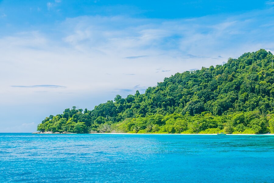
North Sentinel Island
Among the 572 islands that form the Andaman chain in the Bay of Bengal within the Indian Ocean, North Sentinel stands out.
Circled by treacherous reefs, the real source of intimidation emanates from its people. The Sentinelese residing here resolutely oppose engagement with the modern world. Numerous endeavors to establish peaceful interaction have met with staunch resistance. This island is situated 400 miles away from Myanmar.


Leave a Comment
Your email address will not be published. Required fields are marked with *